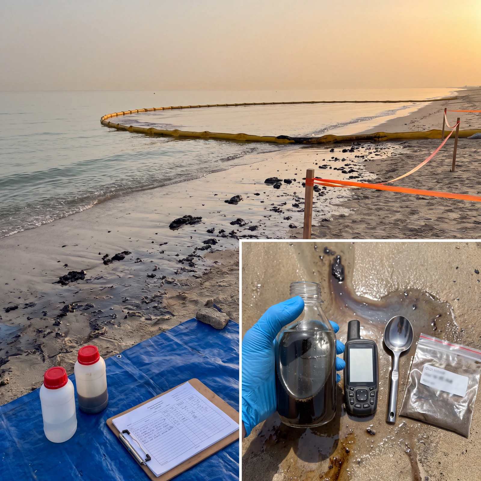
The Ministry of Climate Change and Environment said the national technical monitoring and environmental assessment system detected an oil spill reaching Umm Al Quwain’s beaches in October 2026. It reported odours in Sharjah, Ajman and Umm Al Quwain, with no health risk from those odours. Containment, cordoning and clean-up were under way. All Umm Al Quwain beaches and coastal areas were temporarily closed, and precautionary coastal surveys continued.
That statement sets the context here. The engineering question is what those surveys need to record so that one visit can be compared with the next.
Make the next visit comparable
I would start with the repeat visit, not the first reading. Where relevant, preserve the same coordinates, sampling depth, tidal state and time of day. Record the sampling method, instrument, calibration and field-check condition, date and time, and operator or sampling record. Document deviations clearly rather than making different conditions look equivalent.
This is a practical basis for comparison, not a claim about a particular regulatory requirement. A measurement without enough context may describe one moment but may not support comparison with the next survey.
Know what each measurement can say
For hydrocarbons, a field fluorescence sensor provides rapid screening of hydrocarbon-related fluorescence. It helps build spatial and temporal field observations. That indication does not establish hydrocarbon identity by itself or automatically replace laboratory confirmation.
A grab sample provides a complementary route to analysis by an accredited laboratory. Collection needs control and documentation, using ISO 5667 as the sampling framework, with chain of custody preserving the sample’s documented handling record. A field indication and a laboratory result should remain distinguishable in the record.
Dissolved oxygen (DO) adds supporting environmental context. After a coastal pollution event, it is useful to know the oxygen conditions alongside other observations. An oil spill does not automatically produce a particular DO response, and a change in DO alone does not prove a spill effect.
Turbidity is measured in the field with an optical turbidity sensor using nephelometric measurement of scattered light. It can describe suspended material or disturbance during shoreline activity and clean-up. It is not a direct measurement of oil or proof of hydrocarbon concentration.
Intertidal sediment matters because water measurements alone do not describe the material present in that zone. Document the sampling position, return to a repeatable location and use a consistent collection method, with laboratory analysis where required. Keep the collection context with the result.
The record you cannot collect later
After material reaches the coast, investigators can return for new water samples, sediment samples, photographs and field measurements. They cannot return later and directly measure the actual currents and wind during the spill days. That observational record exists only if those conditions were already being observed.
Time-resolved current speed and direction, and wind speed and direction, provide transport context. An existing monitoring station, with an acoustic Doppler current profiler (ADCP) where appropriate, can preserve part of that record. These observations can help explain where material may have moved and how coastal conditions evolved. They do not identify a source by themselves.
The distinction is observation, then measurement, comparison and interpretation. Post-event results become more useful when a comparable pre-event baseline exists, with known units and methods. Before treating a difference as an explanation, I would ask:
Who holds the pre-spill baseline for that beach, and in what unit?